Barrington Tops Parklands
Overview
The Barrington Coast gets its name from Barrington Tops, the highest point of this part of the New South Wales coastline.
The Barrington Tops parklands is a stunning collection of national parks, state conservation areas and state forests. Together they total 125,000 hectares of wilderness. That’s 1,250 square kilometres to lose yourself in, so take care when venturing into this beautiful region, it has swallowed many planes and people without a trace. And it has also hidden bushrangers and fugitives for years.
Barrington Tops wilderness area forms part of the Gondwana Rainforests of Australia: a network of lush mountainous parks that are World Heritage-listed.
Barrington Tops National Park (northern and eastern precincts): 76,500 hectares
Barrington Tops State Conservation Area (northern precinct): 8,400 hectares
Barrington Tops Tops State Forest (northern precinct): 14,000 hectares
Chichester State Forest (southern precinct): 15,000 hectares
Stewarts Brook State Forest (western precinct): 3,800 hectares
Mount Royal National Park (south west precinct): 6,900 hectares
Barrington Tops is thriving with plants and wildlife, and is an outstanding example of the major stages of Earth’s evolution. You'll discover untouched high altitude rain forests, towering tree fern groves, snow gum meadows and exhilarating mountain views.
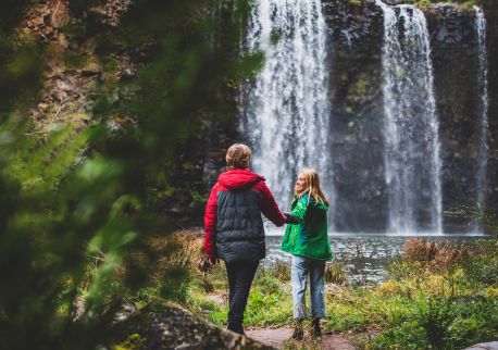
Gloucester is the closest town to Barrington Tops National Park for the popular lookouts, trails, campgrounds, waterfalls and picnic areas on the northern side and eastern side of the park.
You can also access the southern side via Dungog for more beautiful campgrounds, picnic areas, walking trails and swimming spots.
Please note that access to the northern precinct is currently restricted due to a severe crack in the road. Please check the Forestry Commission website before travelling for updates.

